Trails at Fort Kent Outdoor Center
Welcome to Fort Kent's Outdoor Center, where adventure awaits on our Nordic ski, snowshoe, mountain biking, and hiking trails. Explore the beauty of each season, from the thrill of winter sports to the tranquility of forested paths. Embrace the outdoors and discover the extraordinary landscapes that make our trails unforgettable.
Interactive Nordic MapEmbark on a journey through Fort Kent's premier Outdoor Center, where every trail unveils a unique adventure
Welcome to the breathtaking outdoor trails of Fort Kent's premier Outdoor Center! Nestled in the heart of nature's splendor, our diverse trail system offers an adventure for every season and enthusiast. Whether you're an avid Nordic skier seeking the thrill of gliding through pristine snow, a snowshoer craving the tranquility of winter landscapes, a mountain biker ready to conquer challenging terrain, or a hiker yearning to explore the wonders of the great outdoors, our trails are your gateway to unforgettable experiences. With meticulously maintained paths winding through forests and meadows, each trail promises a unique journey that immerses you in the natural beauty of Fort Kent. Discover the joy of outdoor exploration at our Outdoor Center – where every step, pedal, or glide is a celebration of the extraordinary landscapes that define our region.


Get The Latest Trail Conditions On Your Mobile Device
Search your favorite app store or use the links below to download the Nordic Pulse App

Trail Conditions
Interactive Nordic Map
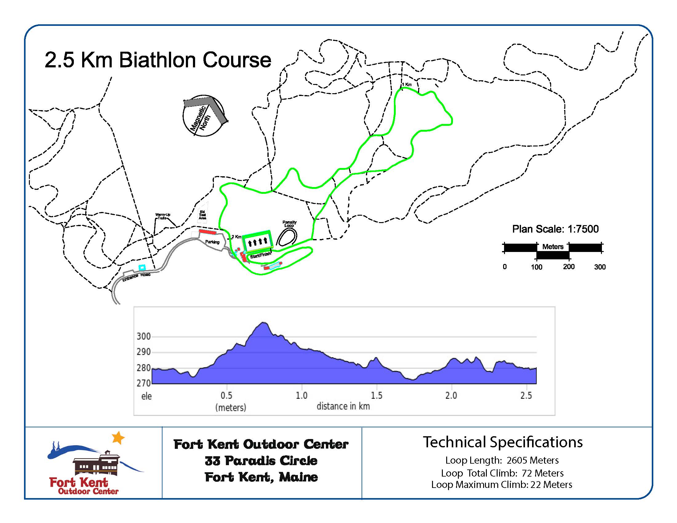
Biathlon Course Maps